Position
38°8.1′N 76°31.7′W
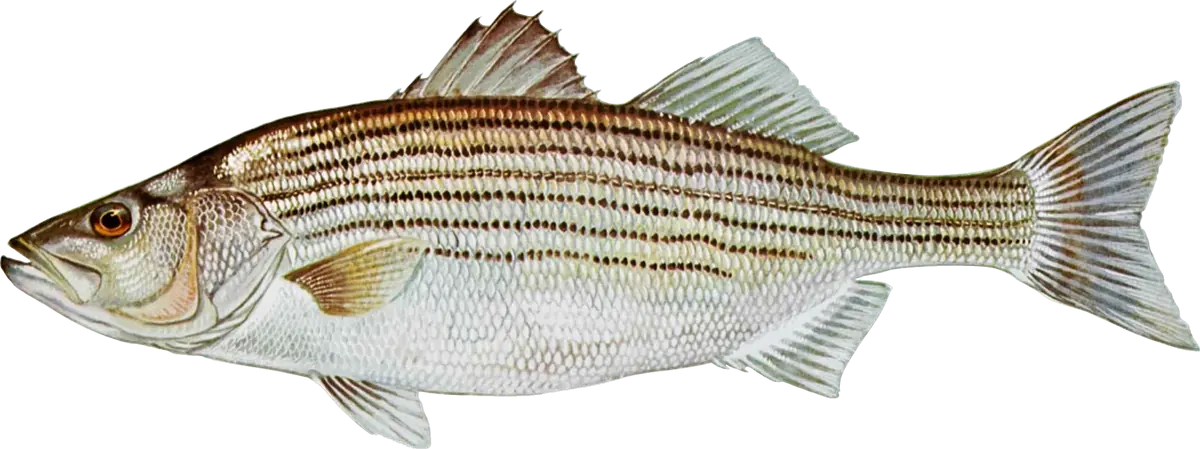
Below the Nice Memorial (Route 301) Bridge, the Potomac widens into a big, salty river whose steep channel edges hold striped bass from late spring to December. DNR's weekly report comes back again and again to the same stretch: the edges from the mouth of the Wicomico River past Cobb Island and St. Clements Island, and above all the steep edge from Piney Point to St. George Island, where boats troll, jig and live-line spot. Summer brings spot, croaker and bluefish, and in late fall DNR often calls the lower river the place to be for stripers.
When to fish
- Winter and early spring: stripers are catch and release only on the main stem, and live eels aren't allowed.
- Late May and June: harvest season on the main stem; trolling tandem-rigged bucktails and swimshads (chartreuse is a favorite) along the Piney Point–St. George Island edge, then live-lining spot as spot arrive.
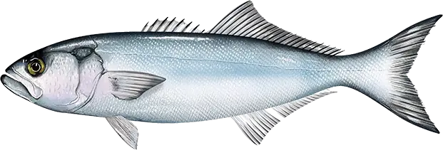
- July and August: the main stem closes to striped bass fishing from early July to late August, and Maryland's tributaries close for August; spot and croaker around Cobb Island and bluefish below the bridge carry the summer.
- September and October: stripers on the edges near the Route 301 Bridge and south past St. George Island, on live spot, jigs and umbrella rigs; bluefish mixed in.
- November and December: peak jigging season from the Wicomico mouth to Piney Point, with fish holding deep, often in about 30 feet, on the steep edges.
Where to fish
- The channel edges around the Route 301 Bridge.
- The mouth of the Wicomico River, Cobb Point and Cobb Island: late-fall stripers, summer spot and croaker.
- St. Clements Island, Carters Lumps and Kettle Bottom Shoals.
- The Line Bar and Sheepshead Bar.
- Piney Point to St. George Island: DNR's go-to edge, and the matching edge along the Virginia side.
How to fish it
- Find the fish first: stripers suspend near the bottom on the steep edges, so work them with a depth finder.
- Jigging: soft plastics or metal jigs heavy enough to reach the bottom in the current; in late fall, larger 6- to 8-inch white or chartreuse soft plastics.
- Live-lining: spot on non-offset circle hooks, which are required with natural bait for stripers on the main stem.
- Trolling: tandem-rigged bucktails and swimshads, or umbrella rigs, behind inline weights.
- Spot and croaker: bloodworm on bottom rigs for spot, peeler crab for croaker.
Getting there
St. Mary's County has public landings at Piney Point (just before the St. George's Island bridge), on St. George's Island, at Tall Timbers, and at Bushwood, Chaptico and Wicomico Shores on the Wicomico River. Charles County has a free ramp at Hatton Creek on the Wicomico and a fishing pier at Southern Park on Neale Sound at Cobb Island. St. Clement's Island State Park at Coltons Point allows fishing. A Maryland Chesapeake Bay and Coastal Sport Fishing License covers the main stem below the Wilson Bridge, but the main stem follows the Potomac River Fisheries Commission's rules and seasons, while the tributaries follow Maryland's.
Right now
Current conditions
- Air
- 56°F
- Wind
- 2 mph
- From the E
- Water
- 68°F
- Sky
- Clear
Tides today · Piney Point, Md., MD
Coastal forecast · ANZ537
Tidal Potomac from Cobb Island to Smith Point
- Tonight
- SE winds 5 kt. Waves flat.
- Wednesday
- S winds 5 to 10 kt. Waves 1 ft.
- Wednesday Night
- S winds 5 to 10 kt. Waves 1 ft.
Issued 757 PM EDT Tue Oct 6 2026
Source: National Weather Service, NOAA Tides & Currents
From the water
Latest reports
No reports yet
No fishing reports have been published for Lower Potomac River (Route 301 Bridge to Piney Point) yet.
Field guide
What you can catch
Close by